Google Earth maps
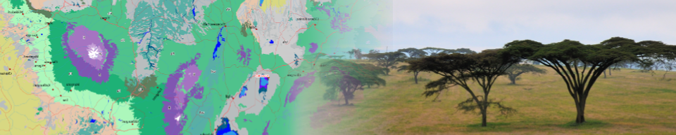
The vegetation map on Google Earth
You can also explore the map by using it as an overlay on Google Earth. Download the Google Earth KML file first, using the link below. If you have installed Google Earth Pro, the downloaded layer will automatically open in Google Earth. Alternatively, you can start Google Earth in your browser (click here). Next, click on Projects (5th icon in the side bar), and next click the button New Project. Select the option Import KML file from computer, and open the KML file you just downloaded.
Once opened, the map consists of two layers, the vegetation map itself and a layer with vegetation labels (letter codes). Click on any of these codes to get the full name of the vegetation type at that location. The pop-up will show with the vegetation name and a link that will open a fact sheet with a concise description of that vegetation type and a list of species naturally occurring in the selected potential natural vegetation type. Download & open in Google Earth
Individual vegetation types
The list below provides for each potential natural vegetation tpe a link that opens a Google Earth layers with points marking the distribution of that vegetation type. Where the vegetation type occurs as a single-type, it is marked with a filled circle with the code of the vegetation type. Where it is mapped as a compound vegetation type, it is marked by a little square with the codes of all vegetation types that are occur within that mapping unit
Distribution of forest vegetation types
- Afromontane rain forest (Fa)
- Afromontane undifferentiated forest (Fb)
- Single-dominant Widdringtonia whytei forest (Fc)
- Single-dominant Hagenia abyssinica forest (Fd)
- Afromontane moist transitional forest (Fe)
- Lake Victoria transitional rain forest (Ff)
- Zanzibar-Inhambane transitional rain forest (Fg)
- Afromontane dry transitional forest (Fh)
- Lake Victoria drier peripheral semi-evergreen Guineo-Congolian rain forest (Fi)
- Zambezian dry evergreen forest (Fm)
- Zambezian dry deciduous forest and scrub forest (Fn)
- Zanzibar-Inhambane lowland rain forest (Fo)
- Zanzibar-Inhambane undifferentiated forest (Fp)
- Zanzibar-Inhambane scrub forest (Fq)
- Lake Victoria Strychnos potatorum scrub forest (Ft)
- Zanzibar-Inhambane scrub forest on coral rag (fc)
- Lake Victoria Euphorbia dawei scrub forest (fe)
- Riverine forest (fr)
- Swamp forest (fs)
Distribution of woodland and wooded grassland vegetation types
- Vitellaria wooded grassland (Wb)
- Dry Combretum wooded grassland (Wcd)
- Moist Combretum wooded grassland (Wcm)
- Acacia-Commiphora deciduous wooded grassland (Wd)
- Acacia tortilis woodland and wooded grassland (WdK)
- Upland Acacia wooded grassland (We)
- Kalahari woodland (Wk)
- Miombo woodland on hills and rocky outcrops (Wmr)
- Drier miombo woodland (Wmd)
- Wetter miombo woodland (Wmw)
- North Zambezian undifferentiated woodland (Wn)
- Mopane woodland and scrub woodland (Wo)
- Terminalia sericea woodland (Wt)
- Vitex-Phyllanthus-Sapium-Terminalia and Terminalia glaucescens woodlands (Wv)
- Chipya woodland and wooded grassland (Wy)
- Edaphic wooded grassland on drainage-impeded or seasonally flooded soils (wd)
- Palm wooded grassland (P)
Distribution of bushland and thicket vegetation types
Distribution of other vegetation types
- Afroalpine vegetation (A)
- Afromontane bamboo (B)
- Desert (D)
- Afromontane desert (Da)
- Grassland (G)
- Lowland bamboo (L)
- Mangrove (M)
- Somalia-Masai semi-desert grassland and shrubland (S)
- Freshwater swamp (X)
- Halophytic vegetation (Z)
- Edaphic grassland on drainage-impeded or seasonally flooded soils (g)
- Edaphic grassland on volcanic soils (gv)
- Vegetation on sand (s)
Disclaimer
Please note that the information here is provided ‘as-is’, and does not come with any warranty or guarantee of any kind. Please also note that the material and geographic designations in this dataset do not imply the expressions of any opinion whatsoever on the part of the authors concerning the legal status of any country, territory or area, nor concerning the delimitation of its frontiers or boundaries. Use of the information, including derived products, must include appropriate citation as provided below.
Citation
van Breugel P, Kindt R, Lillesø JPB, Bingham M, Demissew S, Dudley C, Friis I, Gachathi F, Kalema J, Mbago F, Moshi HN, Mulumba, J, Namaganda M, Ndangalasi HJ, Ruffo CK, Védaste M, Jamnadass R and Graudal L (2015) Potential Natural Vegetation Map of Eastern Africa (Burundi, Ethiopia, Kenya, Malawi, Rwanda, Tanzania, Uganda and Zambia). Version 2.0. Forest and Landscape (Denmark) and World Agroforestry Centre (ICRAF). URL: https://vegetationmap4africa.org