The potential natural vegetation map on your mobile
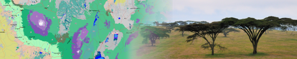
For those working in the field, but also for those who want to learn more about the potential natural vegetation while on safari, you can bring the potential natural vegetation maps with you on your mobile, even when you are off-line.
There are various viewers that work with the maps. Search for MBtiles in Google Store or in Apple Store. One we have tested ourselves is the excellent Locus Map 3 Classic for Android.
Be aware that the files are fairly large. So if you are on a data plan, you might want to download it when connected to WIFI.
Open this page in your mobile browser. Next, click on one of the links below. The map will automatically download and install the map in your Locus map viewer, ready for use in Locus.
Burundi | Ethiopia | Kenya | Malawi | Rwanda | Tanzania | Uganda | ZambiaClick on a link below to download the map for your country of interest. You may have to copy the file to a specific folder or there might be an import function in your application. Check the manual of your map viewer for more instructions.
Burundi | Ethiopia | Kenya | Malawi | Rwanda | Tanzania | Uganda) | Zambia
Citation
Please use the following citation in any materials or publications derived in part or in whole from the data:
van Breugel P, Kindt R, Lillesø¸ JPB, Bingham M, Demissew S, Dudley C, Friis I, Gachathi F, Kalema J, Mbago F, Moshi HN, Mulumba, J, Namaganda M, Ndangalasi HJ, Ruffo CK, Védaste M, Jamnadass R and Graudal L (2015) Potential Natural Vegetation Map of Eastern Africa (Burundi, Ethiopia, Kenya, Malawi, Rwanda, Tanzania, Uganda and Zambia). Version 2.0. Forest and Landscape (Denmark) and World Agroforestry Centre (ICRAF). URL: //http://vegetationmap4africa.org
Disclaimer
The Vegetationmap4africa team and its partners make no warranties or representations, expressed or implied, regarding the use of the material appearing in this dataset with regard to their correctness, reliability, accuracy, or otherwise. Please note that our map was not designed for navigational purposes, for which we advise you to use up to date road maps and/or tools developed for that purpose.
The material and geographic designations in this dataset do not imply the expressions of any opinion whatsoever on the part of the Vegetationmap4africa team concerning the legal status of any country, territory or area, nor concerning the delimitation of its frontiers or boundaries (boundaries were based on the GADM database of Global Administrative Areas). The Vegetationmap4africa team shall not be responsible or liable to any person, firm or corporation for any loss, damage, injury, claim or liability of any kind or character based on or resulting from any information contained in the dataset.