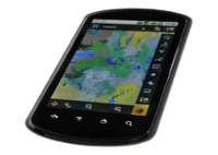
Online map
View the interactive online map in your browser
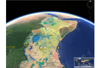
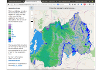
The map of potential natural vegetation of eastern Africa gives the distribution of potential natural vegetation in Ethiopia, Kenya, Tanzania, Uganda, Rwanda, Burundi, Malawi and Zambia.
Potential natural vegetation (PNV) is defined as “vegetation that would persist under the current conditions without human interventions”. As such, it can be considered a baseline or null model to assess the vegetation that could be present in a landscape under the current climate and edaphic conditions, including conditions created or altered by man.
The map distinguishes 48 vegetation types, divided in four main vegetation groups: 16 forest types, 15 woodland and wooded grassland types, 5 bushland and thicket types and 12 other types. The map is available in various formats. For the online version or GIS data, see below. For PDF or paper versions of the map, see the Documentation section.