Tree seed zones
Introduction
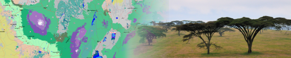
The tree seed zones for 13 important agroforestry tree species in East Africa were developed as a proof-of-concept of mapping tree seed zones based on potential natural vegetation and bioclimatic distances from seed sources. The approach can readily be expanded to other species and any set of seed sources using a new set of tools developed as part of the BiodiversityR package. Note, however, that the maps shown here exclude edaphic vegetation types and compound vegetation types.
Download the Google Earth KML file here
The link above downloads a Google Earth KMZ file that contains zonation maps for 13 important agroforestry tree species in East Africa (Acacia senegal, Bridelia micrantha, Croton megalocarpus, Dalbergia melanoxylon, Faidherbia albida, Markhamia lutea, Olea capensis, Podocarpus latifolius, Prunus africana, Sclerocarya birrea, Tamarindus indica, Terminalia brownii and Warburgia ugandensis).
Maps show tree seed zones for current and mid-21st century climates, modelled using bioclimatic data layers from AFRICLIM. These results were obtained by the Climate-smart Tree Seed Sourcing in East Africa project, funded through CCAFS to the World Agroforestry Centre, the University of Copenhagen and national tree seed centres of Kenya, Tanzania and Uganda.
Instructions
Clicking on a link above will download a Google Earth point layer. If you have installed Google Earth Pro, the downloaded layer will automatically open in Google Earth. Alternatively, you can start Google Earth in your browser (click here). Next, click on Projects (5th icon in the side bar), and next click the button New Project. Select the option Import KML file from computer, and open the KML file you just downloaded.
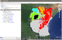
After opening the KMZ file in Google Earth, you can open different seed zonation maps by first opening the folders for a particular species (click on the open triangle left of the check-box for the species folder), then checking the check box for the maps that you are interested in.
Vegetation zones show the distribution of vegetation types where the species is known to occur, whereas consensus zones show the distribution of seed zones based both on vegetation type and bioclimatic distance. The same colour scheme is used for all maps corresponding to the same species (and therefore, if a future seed zonation map does not feature particular colours shown in the current map, this indicates that a particular seed zone is predicted to not to exist in future climatic conditions). The labels correspond to the current distribution of vegetation types.
Hyperlinks in the names of folder link to information of species in Agroforestry Species Switchboard (e.g., Bridelia micrantha) and information on vegetation types (e.g., Combretum wooded grassland).
Methodology
The underlying hypothesis of the methodology is that the best choice of sources of tree planting materials is where (i) the potential natural vegetation type of the planting site matches the potential natural vegetation type of the seed source; and (ii) the bioclimatic distance of the planting site to the selected seed source is smaller than the bioclimatic distance of the planting site to other available seed sources. By including criteria based both on potential natural vegetation and bioclimatic distance, we expect that our approach deals better with uncertainties of predicting future seed zonation than would an approach only based on natural vegetation or only based on bioclimatic distance.
- The location of the seed source was determined by calculating the statistical average for the different bioclimatic variables of all the raster cells belonging to the same vegetation type
- Bioclimatic distance was calculated as the Mahalanobis distance since this distance takes into account correlations among variables
- The future distribution of vegetation types and species was modeled by firstly modelling the distribution of individual vegetation types (using ensemble suitability modelling approaches with BiodiversityR) and by secondly modelling the vegetation map using the suitabilities of individual vegetation types as explanatory variables with a random forest model.
- Future climatic conditions center on 2055 (2041-2070) and represent the mean of ten general circulation models (GCMs) for Representative Concentration Pathways of 4.5 and 8.5 Wm-2.
- Current and future bioclimatic raster layers are at resolution of 150 arc seconds (roughly 5 km at the equator).
Citation
Kindt R, van Breugel P, Lillesø J-P B and Graudal L. 2016. Future tree seed zonation in East Africa determined by potential natural vegetation and bioclimatic distance.